
On Sunday we were ready for an adventure. We had been cooped up in the RV for a little over a day because of strong winds in the area. We did some searching on the internet and decided on Vulture Peak near Wickenburg, AZ.
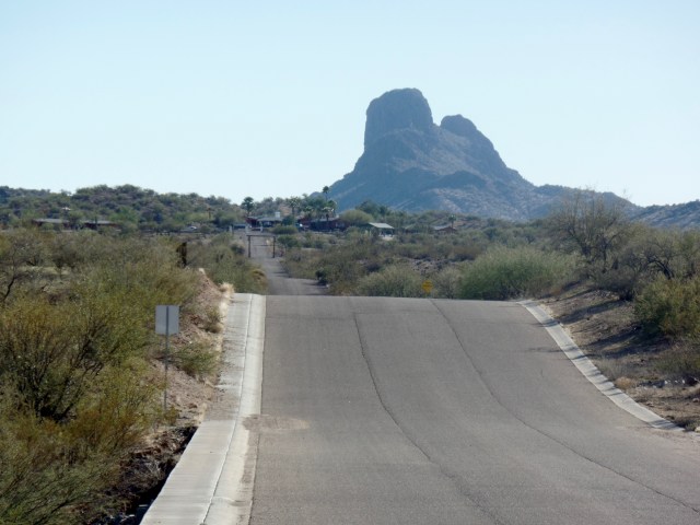
View of Vulture Peak from near Rte 60 in Wickenburg
The trip would serve two purposes, an adventure and an opportunity to get some groceries in a bigger town. Our current town has a very small store with limited supplies.

Grocery store in Salome- there is a Family Dollar as well
The drive to the trailhead could not have been easier, we turned right out of our campground and headed on Rte 60 West for 54 miles, then turned right on to the Vulture Mine Road. The trailhead is about 5-6 miles down the Vulture mine road on the left hand side. There are signs marking the area. When you pull in, you need to drive about 0.5 miles down a dirt road to get to the trailhead. The area you are driving through is BLM land. We saw lots of RV’ers camping in this area for free. This entire area is very popular for off-roading either with side by sides, ATVs or jeeps. Our campground in Salome, AZ is the same, most of the people staying at the campground have ATVs and spend the day riding the trails that go right from the campground.
There are two trails that leave from the trailhead, one is for ATVs the other is for hiking. The final .5-.6 of the trail is limited to foot traffic only, and switchbacks up the steep area to the saddle.
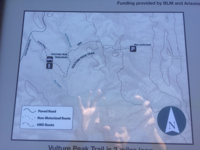
Map at trailhead
You will see they have put up barricades at points where the ATV trail meets up with the hiking trail, I’m sure to limit the use to foot traffic.

One of the barricades along the foot path
We initially started on the hiking trail but got a little turned around when it came to a junction in a wash. The trail signs are not always where you need them. We ended up hiking the ATV trail for about 1 mile, but we don’t think it added on a lot of mileage.

Section of jeep trail we hiked
On the return we stuck to the hiking trail which is much more scenic and brings you through an area dense with Saguaro cactus.
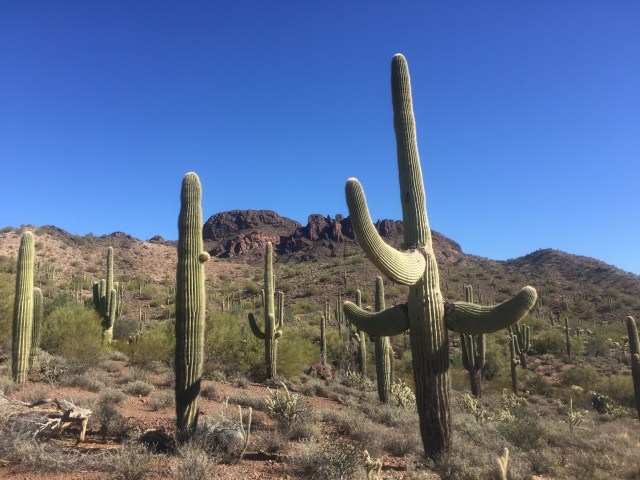
We enjoyed this very scenic hike. The first section is like walking through a southwestern garden.

Teddy Bear Cholla– “jumping” cactus- these disconnect easily at their joints if you brush agains them. You DO NOT want to get these attached to you- PAINFUL! Make sure to bring tweezers and a comb when hiking in the desert.

It’s like walking through a desert garden- not a great shot of the Palo Verde, but if you look close you can see the bright green. These Ocotillo were not leafing out, but we have seen some starting to leaf out in this area.
The second section to the summit is a great workout of switchbacks that bring you quickly to the saddle.

Climbing up through the switchbacks
This is where the official trail ends. We decided to stop here, but many people scramble up to the summit. We could see the route we would take if we had decided to to do this.

View from the saddle looking back towards the area you would climb up to the summit
The views from the saddle were good enough for us. You can look back at the area you came from
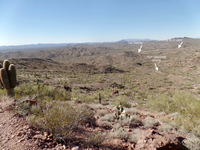
View back- I’ve marked off the different points
and you can look over the other side of the saddle for a different view.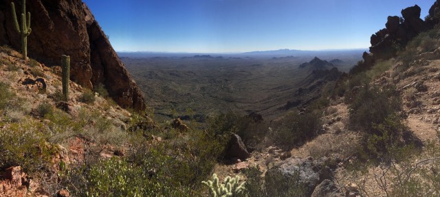
This hike was definitely worth the drive in from Salome. Once down we made our way back out to Rte. 60. The Safeway grocery store is at the junction of the 60 and the Vulture Mine Road so we didn’t even have to drive out of our way to stock up on supplies.

Pingback: The End of the Journey West and the Beginning of the Journey East | gizmogoeswest