
We did tons of hiking while in Las Vegas since there was literally nothing to do at our campground. The following is a summary of 3 additional hikes in Las Vegas that we enjoyed.
The first is the Historic Railroad Trail at Lake Mead. We started in the parking lot near the Lake Mead visitors area. We got there at 0900 and the parking lot was already full, but we were able to get a spot after waiting for a few minutes. Unfortunately for us the bike path and this trail were under construction Monday through Thursday so we had to make the trip on a weekend. Judging by the amount of people on this trail, it is very popular with the locals. We saw several boy scout troops hiking here. We decided to bring Gizmo’s “doggy ride” since we planned on hiking the full 7.6 miles.

Gizmo’s “Doggy Ride”. It can be towed behind a bicycle or with the conversion kit it can be pushed. The wheels pop off and it quickly becomes a portable kennel
We are trying to get him used to the doggy ride so we can use it when we go to events like the camping show in Quartzite. Unfortunately he only took a ride for about 0.5 miles of the hike. He was a pretty lame shih tzu the next day, especially since he insisted on hiking the whole distance at about 4 mph. The first section of the trail is in the shade if you hike in the morning. The shade was very welcome since the weather was in the high 80’s for most of our stay in Las Vegas. The return hike was sunny and hot! The trail is relatively flat until the end when you descend into the Hoover Dam. The really cool thing about this trail is it is built on an old railroad line. The railroad ties are gone but the trail brings you through 5 of the original train tunnels.

5 railroad tunnels
There are great views of Lake Mead for most of the trip.

Views across Lake Mead
Just before you arrive at the dam you walk through a section of power lines.

A display of items from the dam, this is along the trail
There are old artifacts from the dam that you can look at in this section. We hiked only to the parking garage at the Hoover Dam since Gizmo was with us.
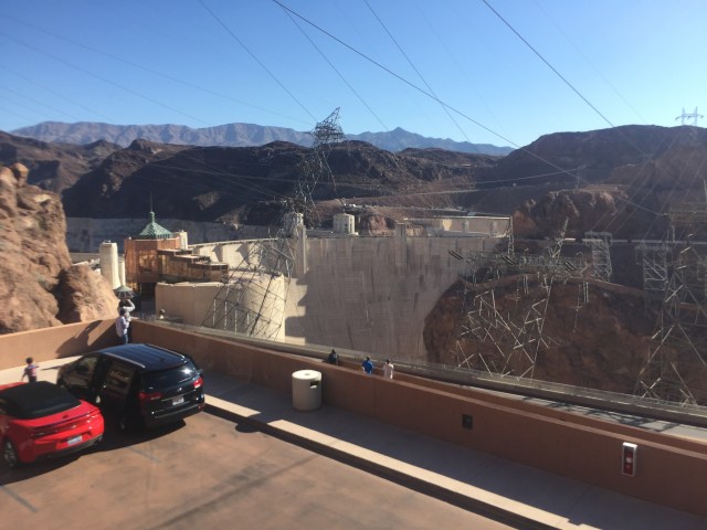
The view of the Hoover Dam from the parking garage. Dogs are not allowed to walk on the Hoover Dam
Dogs are not allowed on the Hoover Dam. If you have not been on the “dam tour” this would be a great way to break up the hike, by taking a tour at the turnaround point.
The second hike we did was Turtlehead Peak at Red Rock Canyon.
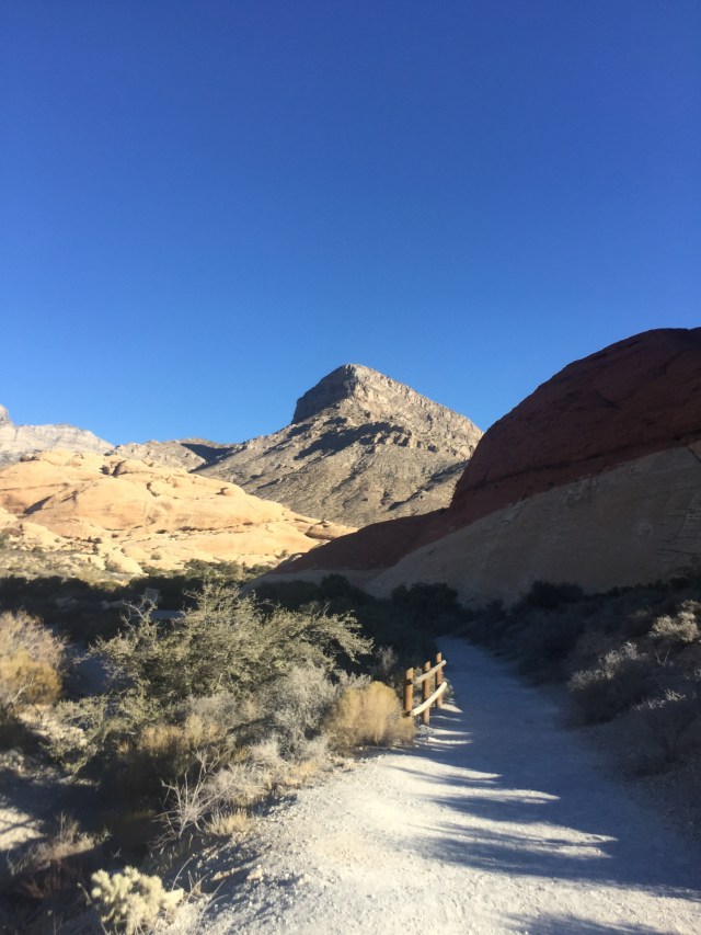
View of Turtlehead Peak from the trail
The day was supposed to be cooler and we got a really early start so we thought we were good. We were on the trail by 0730. We were roasting by 0745. The trail is about 2.25 miles long each way and we were only 1/2 mile in. Gizmo was not liking the heat and he was still not completely recovered from the long hot hike at Lake Mead. We took it slow but about 1 mile in we really started to climb and it was obvious that Gizmo was not going to tolerate the heat and there was no place to cool off in the shade.

Views from about 1 mile up Turtlehead Peak- this was Gizmo’s turnaround point- No shade here
John opted to take Gizmo back to the car while I finished up the hike. The next 1.25 miles were straight up with no official trail. You can see where someone had come through and marked blue on the rocks and someone else had put green tape along the route. You pretty much just make your way up to the saddle using the most obvious route. This is a pretty popular trail so you usually have someone to follow.
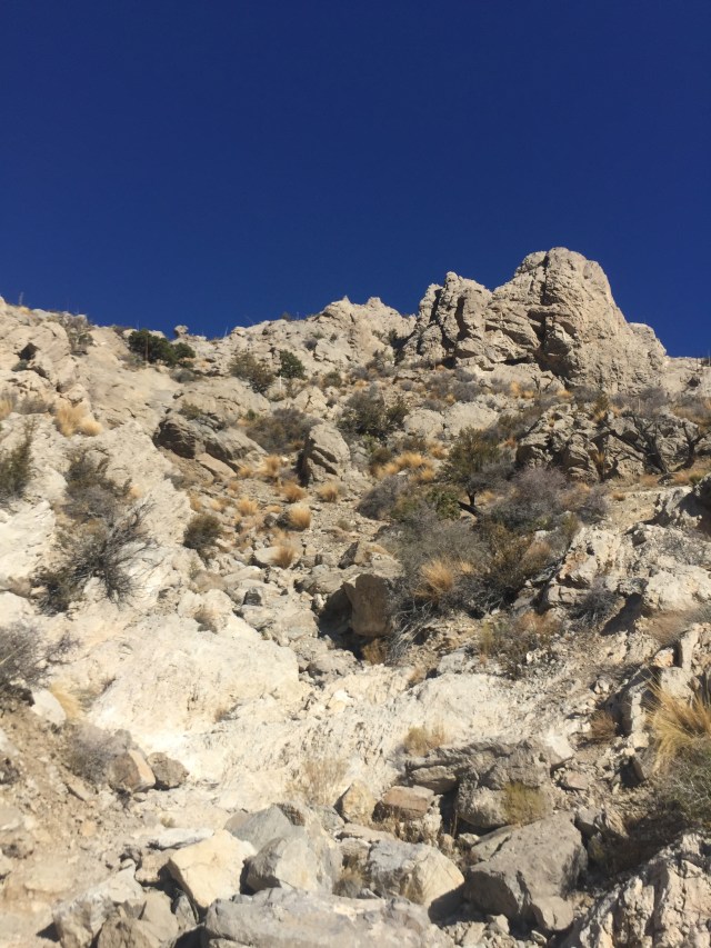
View up towards the saddle- no official route- very steep
Once you get to the saddle it gets a little more difficult. You turn to the right and hike towards the summit looking for a clearing to make a push to the top. There were 3 other people in front of me and I think we all took a separate route but all ended up on top. There is a small black box at the summit with a book to sign and some things that others had left.

Box at summit
The views into Red Rock Canyon are excellent

View from summit of Turtlehead Peak
and the views looking back are towards the city of Las Vegas.  The 4 of us on the summit agreed that we would all hike down together since we were not exactly sure of the best trail. I was really glad that I had my poles with me for the descent since the trails had small loose rocks on in it and it was extremely steep. I was really glad that John and Gizmo had turned back, the heat combined with the very steep climb up 2000 vertical feet would have been too much.
For our final hike we decided to go back to the Spring Mountains. We wanted to treat Gizmo to a nice cool hike in the trees after the 2 very hot sunny hikes we had taken this week. This was the perfect choice for us and it was so nice to get into some cool crisp air. We decided to climb from the North Loop Trailhead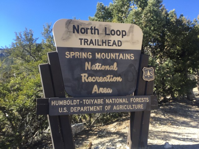 up towards Mummy Springs, our goal was to hike up into the Ancient Bristlecone Pines
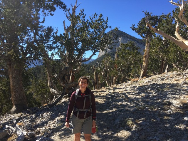
Mummy’s Toe is the rock formation behind me
and see the Rain Tree.

The Rain Tree- an Ancient Bristlecone Pine
This tree is over 3000 years old and it is one of the largest in the area. 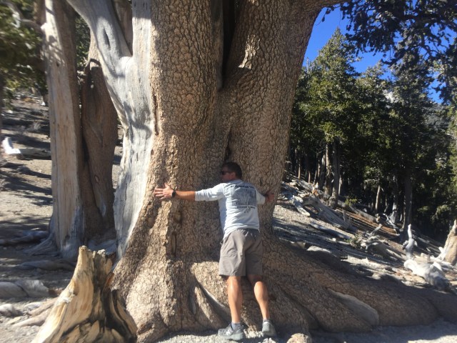 The tree is located at the trail junction where you turn right to go to the springs. We decided the hike to this point was far enough. We spent a bit of time in this area having lunch and admiring the Ancient Bristlecones and the views. The temperature was about 55 degrees for most of the hike and we had filtered sunshine. The hike was just shy of 6 miles round trip and over 1700 feet of elevation gain. We had brought along the new “gizmo pack” just in case he got tired but John just ended up using it as a pack.

Gizmo enjoying the cool crisp air- the K9 Sack works great as a pack too
There is nothing like cool mountain air to get him to hike like he is 1/2 his age. We decided to take Rte 158 to Rte 156 to get back to the highway 95. I am really glad we took this route. There is a desert view overlook a little beyond where we hiked on rte 158 that is definitely worth the stop. There is a short paved trail about .25 miles long with interpretive signs about the scenery. There is a lot of information here about military testing, particularly testing of nuclear weapons. We spent about 1/2 hour here taking in the sights and reading the trail signs.

Pingback: The End of the Journey West and the Beginning of the Journey East | gizmogoeswest